


GIS | December 2025
Rapid Ground Truthing: Revolutionizing Geospatial Accuracy with Drone Technology

Introduction
Ground truthing is a core practice in geospatial science. It ensures that data collected from remote sensing, such as satellite or drone imagery, accurately reflects the real-world environment. With the rise of drone technology, rapid ground truthing has become increasingly important for delivering reliable, high-precision maps and models across various industries.
What is Ground Truthing?
Ground truthing is the process of validating and calibrating remotely sensed data with on-the-ground measurements. Typically, this involves placing ground control points (GCPs) at strategic locations. Surveyors use precise equipment to record the exact coordinates of these points, which serve as reference markers for correcting and calibrating aerial data.
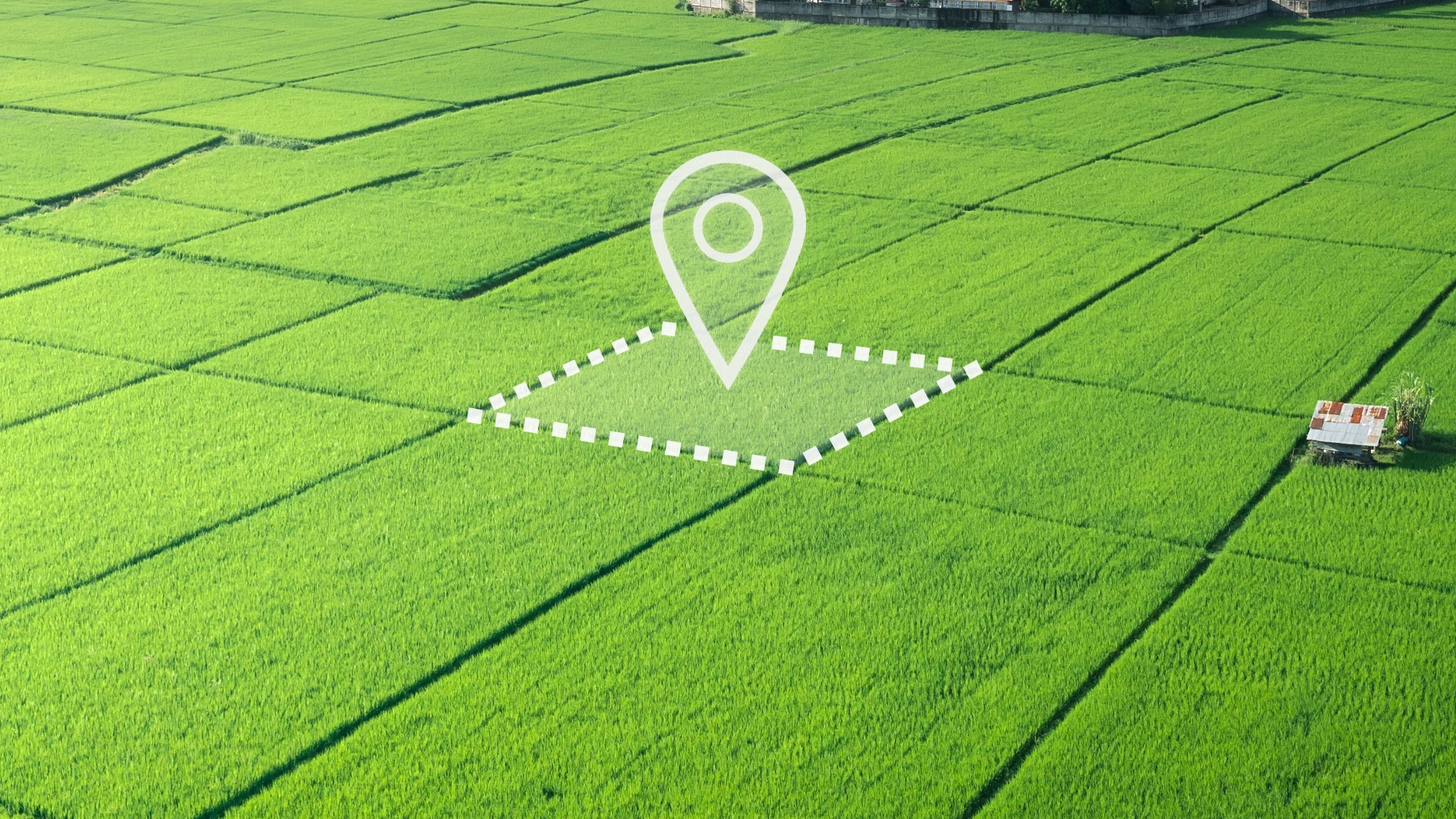
Figure 1 : Mapped Field
The main value of ground truthing is its ability to minimize positional and elevation errors. This results in centimeter-level accuracy, which is crucial for sectors such as infrastructure development, legal boundary surveys, and disaster management. Even small errors can have major consequences in applications such as flood modeling or landslide risk assessment.
Challenges in Traditional Ground Truthing
Traditional ground truthing, while essential for accurate data validation, can be resource-intensive. It demands specialized equipment, skilled professionals, and extensive fieldwork, often extending project timelines and increasing costs. These factors sometimes lead organizations to forgo this process, which can result in compromised data quality and less reliable outcomes.
The Emergence of Rapid Ground Truthing
Drones have emerged as a fast and modern method for rapid ground truthing, enabling high-resolution data collection over large or difficult areas. Ground truthing validates this drone data and helps refine AI models to ensure precise, reliable insights. This integration of drones with ground truthing accelerates mapping processes and enhances the accuracy needed for confident project decisions.
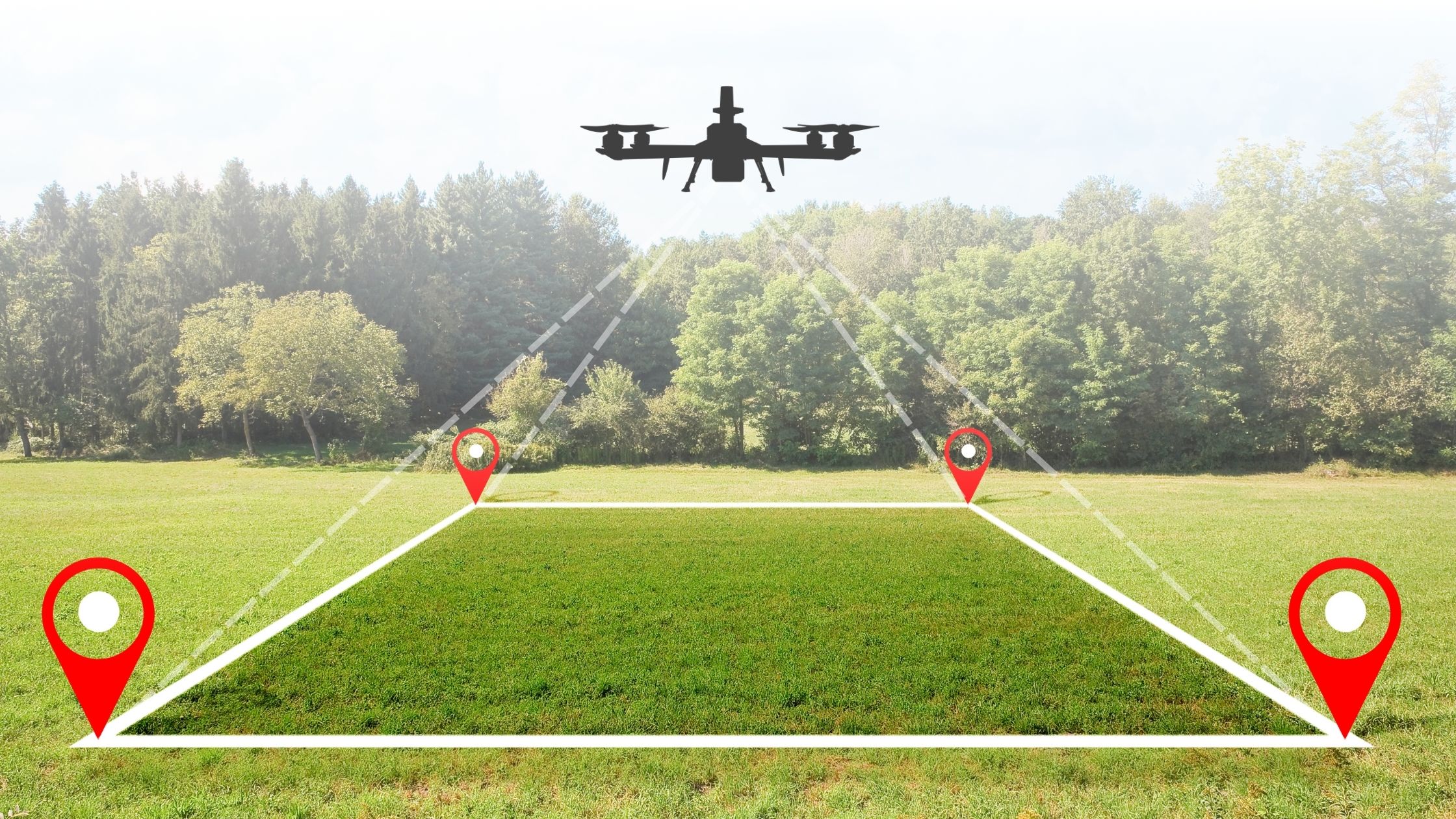
Figure 2: Visual representation of drone mapping
Advancements in drone technology have led to rapid ground truthing methods. Real-Time Kinematic (RTK) and Post-Processed Kinematic (PPK) GPS correction systems are now widely used. RTK provides real-time corrections during flight, while PPK applies corrections after the flight, both significantly improving data accuracy.
How RTK and PPK Work?
RTK (Real-Time Kinematic) technology connects the drone to a base station or reference network, providing instant, high-precision positioning during the flight. This allows for real-time corrections without the need for extensive post-processing, enabling faster access to accurate data and reducing the reliance on numerous ground control points.
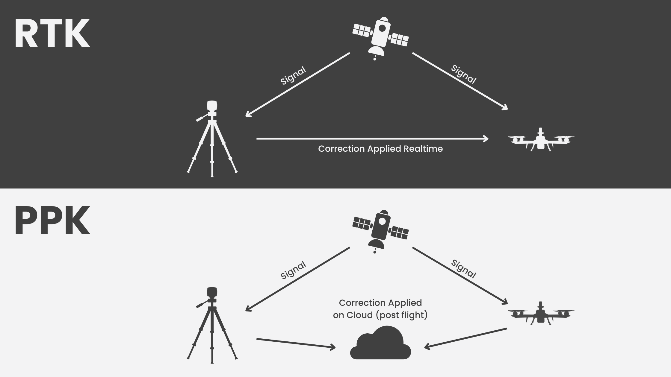
Figure 3: Concept of RTK & PPK
Conversely, PPK (Post-Processed Kinematic) corrects the GPS data after the flight, making it ideal for areas with poor or no live connectivity. PPK offers a robust workflow with high accuracy by matching drone data with base station information post-flight. Both RTK and PPK streamline survey operations and significantly enhance mapping precision.
Selecting between traditional and rapid ground truthing depends on project needs, site conditions, and accuracy requirements. RTK-enabled drones are ideal for real-time decision-making, while PPK suits detailed surveys where post-flight processing is feasible. Combining these methods with a few GCPs can further enhance accuracy.
Benefits of Rapid Ground Truthing
Rapid ground truthing methods offer significant advantages for large-scale or time-sensitive projects. By reducing setup and processing times, these techniques enable organizations to deliver actionable, high-precision data much faster than traditional methods.
This speed is especially valuable in dynamic environments such as construction sites, pipeline monitoring, or active mining operations, where timely and accurate information is critical for effective decision-making and operational efficiency. The ability to quickly adapt and respond to changing conditions helps project teams maintain safety, meet tight deadlines, and optimize resource allocation.
Industry Applications of Rapid Ground Truthing
Rapid ground truthing using drones is streamlining data collection and validation across multiple industries:
- Agriculture: Drones provide detailed crop health monitoring, pest management, yield forecasting, and soil analysis, enabling precision farming and optimized resource use.
- Construction and Infrastructure: Quick, accurate site surveys and progress tracking ensure safer and more efficient project management, reducing delays and costly errors.
- Mining: Drone-based mapping speeds up volumetric measurements and site monitoring, improving operational safety and decision-making in challenging terrains.
- Environmental Monitoring: Drones support wildlife tracking, vegetation analysis, and land use change detection, critical for conservation efforts.
- Disaster Management: Timely data collection and validation aid in flood modeling, landslide risk assessment, and rapid response planning in dynamic emergencies.
- Urban Planning and Real Estate: Accurate land use classification, property assessments, and maintenance monitoring benefit from integrated drone and ground data.
By leveraging drones for precise aerial data capture combined with rigorous ground validation, industries gain reliable and actionable insights that enhance decision-making accuracy and improve project outcomes. This integrated approach enables stakeholders to optimize operations, mitigate risks, and achieve greater efficiency across a broad range of applications.
Indrones enhancing Ground Truthing
Indrones has played a pivotal role in transforming India’s digital land records by deploying high-precision drone technology across thousands of villages through the SVAMITVA initiative. Our drones capture precise aerial data, enabling the rapid creation of accurate property maps and official records. With solutions like the Eigenspace Suite, we streamline the entire process—from data capture and analysis to visualization.
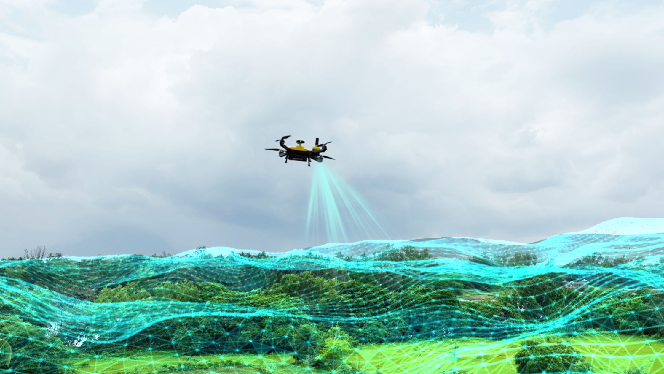
Figure 4: Indrones’ Sigma25 enabling Rapid Ground Truthing
This results in faster surveys, reduced manual effort, and real-time insights. This approach gives millions of villagers legal proof of ownership, reduces land disputes, and opens financial access through property-backed loans. By January 2025, we had mapped over 3 lakh villages and issued millions of property cards, showcasing our commitment to transparent, efficient, & scalable rural land administration across India.
The Future: Drones and Ground Truthing
The integration of drone technology with robust ground truthing practices is setting new standards for geospatial data quality. By combining precise aerial data with verified ground measurements, organizations can achieve higher accuracy and reliability in their mapping and analysis.
This dual approach empowers stakeholders to make well-informed decisions with confidence, ultimately leading to more successful project outcomes. Investing in both aerial and ground-based data collection enhances the depth and validity of insights, driving improvements across various sectors, including construction, agriculture, environmental monitoring, and disaster management.
Conclusion
Ground truthing remains a foundational practice in ensuring the accuracy and reliability of remotely sensed geospatial data. With advancements in drone technology and the rise of rapid ground truthing methods, organizations now have access to faster, more precise data collection and validation techniques. Technologies like RTK and PPK have streamlined survey operations, enhancing mapping accuracy while reducing fieldwork complexities.
This modern approach is critical for industries ranging from agriculture to disaster management, enabling timely, informed decision-making based on actionable insights. As drone integration deepens, rapid ground truthing will continue setting new benchmarks in geospatial intelligence, driving successful project outcomes across sectors.