


Architecture, Engineering, and Construction (AEC)
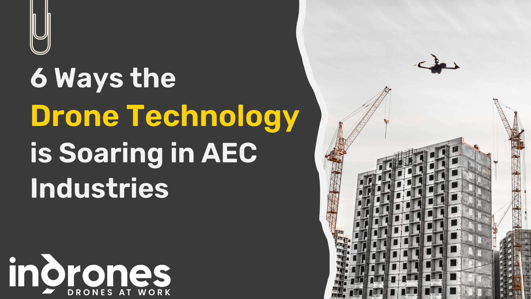
The Use of Drone Technology in India is Soaring in AEC Industries
Construction companies in India are transforming, driven by the seamless integration of innovative technologies. For Architecture, Engineering, and Construction companies, these advancements including the use of drone technology for periodic surveys and inspections stand as game-changers - propelling projects to unprecedented heights of efficiency, precision, and safety.
Soaring Above the Competition: Precision at Every Altitude
The days of relying solely on ground-based surveys will soon be behind us - of manual measurements, which are limited in scope and accuracy. Drones, equipped with cutting-edge sensors and cameras, offer a bird's-eye perspective, capturing high-resolution images and generating detailed 3D models of construction sites. Imagine sweeping over expansive landscapes in mere hours, covering a large area in a single flight. Drones also effortlessly navigate intricate structures, reaching areas inaccessible to traditional methods, like steep slopes or unstable shafts. This unparalleled precision ensures every inch of your project is meticulously documented, providing a comprehensive understanding of terrain, structures, and overall progress.
Efficiency at Its Finest: Swift Surveys and Cost-Effective Solutions
Ditch the days of time-consuming, labor-intensive manual surveys. Drones, with their remarkable agility, revolutionize the data collection process. Imagine effortlessly traversing large areas, completing inspections and surveys in a fraction of the time compared to traditional methods. This translates to more frequent inspections, allowing for proactive project monitoring and management. But the benefits extend beyond speed. Drones significantly reduce project costs by minimizing reliance on manual labor and expediting data acquisition and processing. This cost-effectiveness frees up resources, empowering project teams to focus on critical construction aspects.
Safety First: Minimizing Risks and Prioritizing Well-being
In the inherently risky environment of construction, safety is paramount. Drones offer a safer alternative to traditional inspection methods, especially in hazardous areas. Imagine eliminating the need for personnel to scale precarious heights or maneuver through unstable structures. Drones collect data with precision, minimizing human exposure to potential dangers. This not only protects lives but also establishes a new standard for safety in the industry.
Real-Time Insights, Proactive Decisions: A Data-Driven Approach
Drones usher in an era of real-time monitoring, empowering project managers with immediate access to critical data. Imagine receiving live, secure, and timely data feeds, allowing you to identify and address issues as they arise. This proactive approach ensures you stay ahead of the curve, mitigating risks and adapting to project dynamics seamlessly.
Beyond Bricks and Mortar: Comprehensive Structural Inspection and Environmental Responsibility
Drones go beyond surveying mere structures. Imagine inspecting complex facades,
rooftops, and towering structures with ease. Their versatility extends to a range of
payload options, including mapping and surveillance cameras, and providing detailed
insights into the health of your project. Thermal imaging cameras even unlock the
ability to detect hidden threats, ensuring proactive maintenance and minimizing
future complications.
Furthermore, drones play a crucial role in environmental responsibility. Imagine
monitoring ecological changes and ensuring compliance with regulations from a
bird's-eye view. This proactive approach to environmental impact assessment fosters
sustainable construction practices, minimizing harm to the surrounding environment.
Enhanced Collaboration and Communication: Building a Cohesive Team
Drones foster a culture of collaboration by providing shared visual data from unique perspectives. Imagine architects, engineers, and clients viewing the project through the same lens, a detailed 3D model or high-resolution orthomosaic. This shared understanding leads to more effective communication, streamlined workflows, and a cohesive team working toward a common goal.
How Indrones Can Add Value to AEC Industries
In the dynamic landscape of Architecture, Engineering, and Construction (AEC) industries, Indrones emerge as a game-changer. Indrones conducts personalized client consultations to craft bespoke solutions for site planning, design, progress tracking, and project management needs. Thus, offering end-to-end solutions that seamlessly integrate into various stages of project development. Let's explore how Indrones can elevate AEC processes across different phases.
Site Analysis: Precision in Site Planning
In the crucial phase of site planning and analysis, Indrones introduces a new paradigm through aerial surveys conducted with precision. Leveraging drone technology, topographic surveys become a breeze, enabling convenient and accurate data collection. Indrones' commitment to precision ensures that architects and engineers can make informed decisions during site analysis & survey.
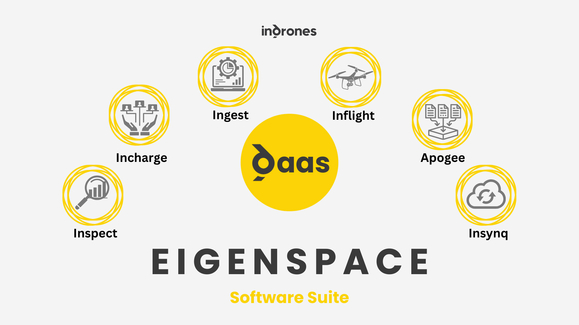
Planning & Design: Elevating Creativity with Eigenspace Suite
As projects progress to the planning and design stage, Indrones integrates its groundbreaking Eigenspace suite. This software suite becomes the backbone for data collection, processing, and overall project management. By combining drone-collected survey data with Eigenspace, architects and engineers gain a comprehensive 3D imagery platform. This platform allows for meticulous comparisons with actual designs, aiding in precise decision-making on elements such as building location and drainage points. Indrones' technology fosters creativity and accuracy in the design process.
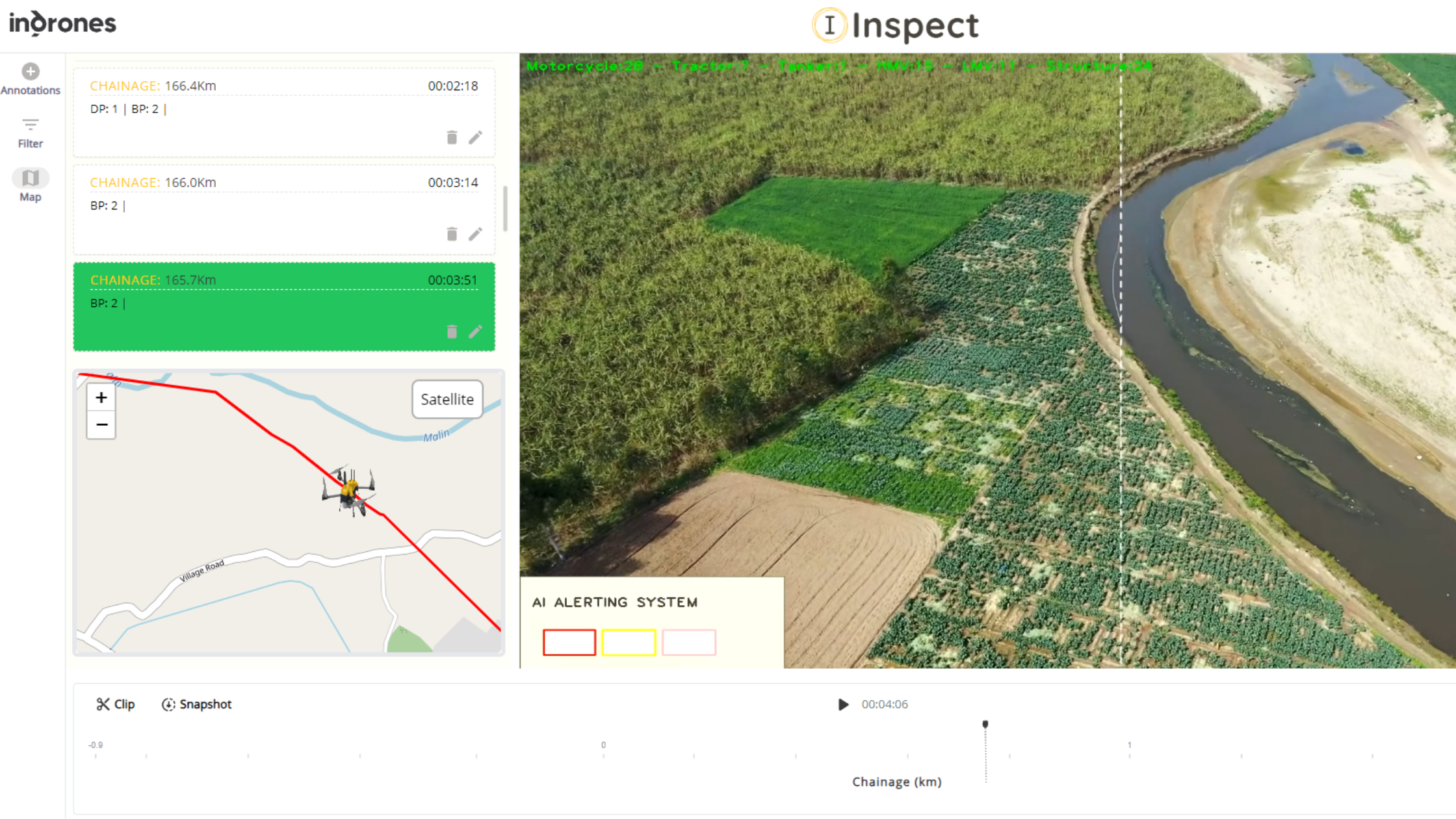
Project Reporting and Collaboration: Streamlining Execution
During the site execution phase, Indrones continues to add significant value through effective project management. All data, seamlessly integrated into the Eigenspace suite, becomes a collaborative hub for multiple teams. Indrones facilitates streamlined collaboration by providing visualization tools and regular surveys. This empowers project managers and teams to easily track progress against the plan, ensuring that the execution aligns with the envisioned design. The visual representation and real-time data contribute to informed decision-making throughout the construction process.
Comprehensive Solutions from Indrones: End-to-end Excellence
Indrones recognizes that providing an end-to-end service is vital for client satisfaction and project success. The commitment extends to offering:
- a) Drone Hardware and Accessories: Delivering cutting-edge drone technology, tailored to the specific needs of AEC projects. Products like Sigma 25 & Sigma 75 can be used as per requirements.
- b) Eigenspace Suite: Empowering project management, mapping, data collection, visualization, and analysis.
- c) Training Services: If drones are purchased and operations are carried out by in-house teams, then it is Indrones’ responsibility to make them proficient in their operation.
By opting for Indrones' services, clients receive a holistic solution that covers all three elements. This comprehensive approach positions Indrones as a strategic partner, providing unparalleled support and innovation at every stage of AEC project development. In summary, Indrones' commitment to precision, creativity, and streamlined project execution makes it an invaluable asset in the dynamic and competitive realm of AEC industries.
Conclusion: Embracing the Future of AEC
The integration of drone technology for periodic surveys and inspections is not just a technological advancement; it is a strategic leap toward a more efficient, precise, and sustainable AEC industry. By embracing this transformative power, Indrones can help you empower your projects to soar above the competition, achieving unparalleled success in today's dynamic construction landscape. So, why settle for grounded projects when you can take flight with the future of AEC? Embrace drone technology and witness the transformation of India's construction landscape.
Keep Reading...
GIS | March 2024
How Drones are Transforming Indian Mining Industry: A Comprehensive Analysis
In the rapidly evolving world of technology, Geographic Information Systems (GIS) and Remote Sensing have emerged as powerful tools for data collection..
Oil & Gas | November 2023
Flying Safeguard: Transforming Pipeline Inspection with Drones and Data Analytics
In the complex and vital realm of critical infrastructure, safeguarding the integrity of pipelines....
Mining | December 2023
How Drones are Transforming Indian Mining Industry: A Comprehensive Analysis
Indian mining companies, a crucial pillar of economic development, are experiencing a remarkable....